Digital Skills Transform Lives
After completing our digital literacy program, Maria started her own online business, selling handmade crafts to customers worldwide.
"From the steadiness of land to the rhythm of water and the mystery of the sea, HelloGeo weaves understanding into every element. It gives people the courage to explore, the wisdom to decide, and the power to reshape their tomorrow. For when the world becomes readable, people become unstoppable"
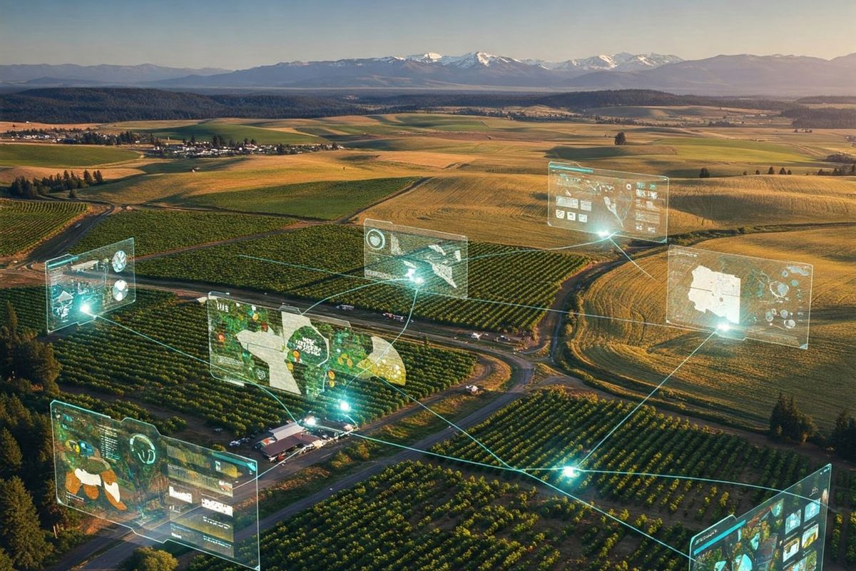
HelloGeo Empowers is our commitment to leveraging geospatial technology for positive social impact. We believe that location intelligence can solve some of the world's most pressing challenges.
Through strategic partnerships, community engagement, and innovative solutions, we're creating a more sustainable and equitable world. Our initiatives focus on education, environmental conservation, disaster response, and urban development.
Countries Reached
Projects Completed
Lives Impacted
Partner Organizations
Recognition of our commitment to excellence and social impact
Why HelloGeo Qualifies: • Autonomous drone infrastructure (ArtPole) • AI-driven geospatial analytics • Large-scale LiDAR & mapping workflows Application Statement: HelloGeo is redefining the future of geospatial intelligence with its fully autonomous ArtPole drone station, AI-powered change detection, and city-scale digital twin engine. Our platform delivers real-time, high-precision insights for infrastructure, utilities, energy, and smart cities. With deployments across power utilities, metro networks, ports, renewables, and underground infrastructure, HelloGeo enables 50–70% faster inspections, 30–40% cost reduction, and near-zero human risk. We are proud to nominate HelloGeo for the Geospatial Excellence Award for its transformative impact across Asia and emerging global markets.
Why HelloGeo Qualifies: • Used for metro, traffic, utilities, crime scene mapping • Real-time ICCC (Integrated Command Control Center) integration Application Statement: HelloGeo enables cities to become self-aware digital ecosystems. Through autonomous drone inspections, AI-based urban analytics, and real-time 3D twins, our platform empowers governments with actionable insights for safety, mobility, energy optimization, and disaster response. HelloGeo is nominated for transforming urban governance through automation, precision mapping, and predictive intelligence.
Why HelloGeo Qualifies: • ArtPole: India’s first Drone-on-Pole autonomous station • Fully automated thermal, LiDAR, RGB, SLAM missions Application Statement: HelloGeo’s ArtPole system is a breakthrough in autonomous UAV operations, delivering repeatable missions without human pilots. It transforms inspections for solar farms, power lines, refineries, ports, and wind turbines, providing continuous data while eliminating downtime and risk. ArtPole stands as a pioneering innovation in autonomous drone infrastructure and deserves global recognition.
Why HelloGeo Qualifies: • Forest monitoring, mangrove mapping, river restoration, pollution detection • Air quality, emissions, water-body assessment using drones + AI Application Statement: HelloGeo’s geospatial AI platform supports national and global sustainability missions by enabling accurate climate monitoring, carbon accounting, biodiversity assessment, and sustainable infrastructure planning. Our autonomous drone ecosystem reduces inspection emissions by up to 80%, supports UN SDG 6, 7, 9, 11, 13, and 15, and empowers agencies to scale environmental action with real-time intelligence.
Why HelloGeo Qualifies: • Tactical ArtPole station • Thermal + night ops + SLAM for denied-GNSS environments Application Statement: HelloGeo supports national security missions through autonomous surveillance posts, 3D terrain intelligence, and rapid tactical mapping. Our ArtPole Tactical variant enables persistent monitoring for border areas, critical assets, and disaster-struck zones. The system’s AI-driven threat detection and autonomous sortie capability mark a new era for defence geospatial readiness.
Why HelloGeo Qualifies: • Proven use cases: Tata Power, Suzlon, NTPC (solar), JSW (thermal) • Predictive alerts, structural deviations, sag & clearance AI Application Statement: HelloGeo brings AI-driven reliability to critical national infrastructure. Our platform delivers predictive maintenance insights for power grids, wind farms, solar stations, and heavy industry through autonomous drone missions and digital twins. We nominate HelloGeo for its measurable impact on reducing downtime, increasing energy efficiency, and enabling safer infrastructure operations.
Why HelloGeo Qualifies: • Combination of AI, robotics, SLAM, LiDAR, and autonomous systems • Rapid adoption across infrastructure & environmental sectors Application Statement: HelloGeo is a deep-tech startup shaping the future of autonomous geospatial intelligence. Through ArtPole and the HelloGeo GCS platform, we deliver real-time environmental, industrial, and urban insights at national scale. Our breakthrough technology positions HelloGeo as a global deep-tech leader worthy of Startup of the Year recognition.
Why HelloGeo Qualifies: • Contributes to SDG 6, 7, 9, 11, 13, 15 Application Statement: HelloGeo empowers governments and corporations to operationalize the UN Sustainable Development Goals through accurate geospatial intelligence, climate monitoring, renewable-energy optimization, and disaster resilience mapping. By enabling automated environmental insights at scale, HelloGeo accelerates SDG-aligned action across continents
Why HelloGeo Qualifies: • BIM integration, as-built vs as-designed analytics • Metro, highway, port & city development digital twins Application Statement: HelloGeo’s integrated LiDAR, photogrammetry, and BIM validation engine brings precision, transparency, and automated progress tracking to mega infrastructure projects. We nominate HelloGeo for revolutionizing digital construction delivery and improving planning accuracy across complex infrastructure ecosystems.
Why HelloGeo Qualifies: • End-to-end platform from capture → processing → AI → insights • Works across UAV, UGV, vehicle-based sensors, pole stations HelloGeo transforms raw aerial and ground-captured data into operational intelligence through an integrated AI geospatial engine. It standardizes workflows across utilities, cities, defence, energy, and transportation. This nomination recognizes HelloGeo as an innovation leader in AI-powered geospatial analytics.