A B O U T T H E P R O J E C T
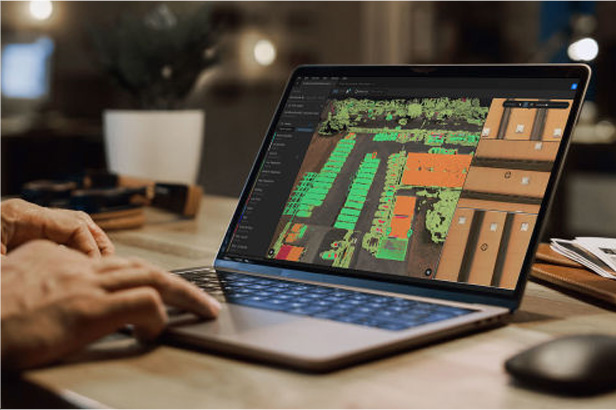
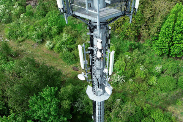
The project aimed to boost defect detection Accuracy and Efficiency for PGCIL Towers, addressing issues like Rusting, Glass Disc Damage, and more. It generates four types of reports (RGB, Thermal, LiDAR, Summary) for precise and efficient defect identification and management.
O B J E C T I V E
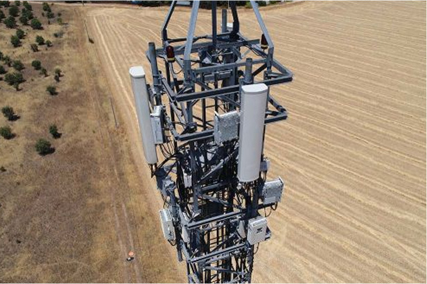
The core objective is to comprehensively assess the PGCIL towers, identifying issues such as Missing, Damaged, or Bent Tower Members, Bolts, and Bird guards. The study employs a Thermovision camera to detect Hotspots and Ensure Safety and Reliability while addressing critical concerns like Missing or Loose Jumper Bolts.
T E C H N O L O G Y U S E D
-
I M A G E C A P T U R I N G
- MAVIC 3T Drone
- L1 Sensor
-
R E P O R T G E N E R A T I O N
- HelloGeo: RGB Reports
- Thermal Analysis Tool: Thermal Reports
- HelloGeo Terrain: LiDAR Reports
B E N E F I T S
1. Enhanced Safety:
It eliminates the need for Personnel to Physically Climb or Access high structures,
reducing the Risk of Accidents and Injuries.
2. Accuracy
High-resolution imagery and sensors provide Precise Data, enabling the detection of Defects and Issues that might be missed during manual inspections.
3. Data Integration
Drones can access Hard-to-Reach or Hazardous Locations, allowing for inspections in Challenging Environments.