
GCP collection
Define inputs, access requirements and acceptance criteria with the HelloGeo team before operational deployment.
From the field. Into your workflow.
A mobile field-data application for GNSS and RTK point collection, ground control points, geotagged media and project synchronisation.
Collect coordinates with Point. Review the collection in MetaSync. Bring control and overlapping imagery into Suite, then check the result against independent survey points.
Explore the published capability areas. Product configuration and deployment scope determine availability.
Connect a compatible HelloGeo Point receiver over Bluetooth Low Energy and use NTRIP/RTCM corrections on the documented Android workflow.
Organise GCPs, survey observations and associated media in project collections.
Move field information into the wider HelloGeo workflow.
Store distributions are available for both mobile platforms; the feature sets and device requirements differ.
Define inputs, access requirements and acceptance criteria with the HelloGeo team before operational deployment.
Define inputs, access requirements and acceptance criteria with the HelloGeo team before operational deployment.
Define inputs, access requirements and acceptance criteria with the HelloGeo team before operational deployment.
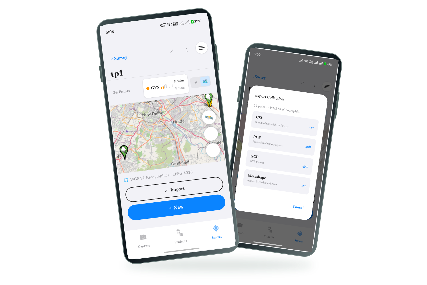
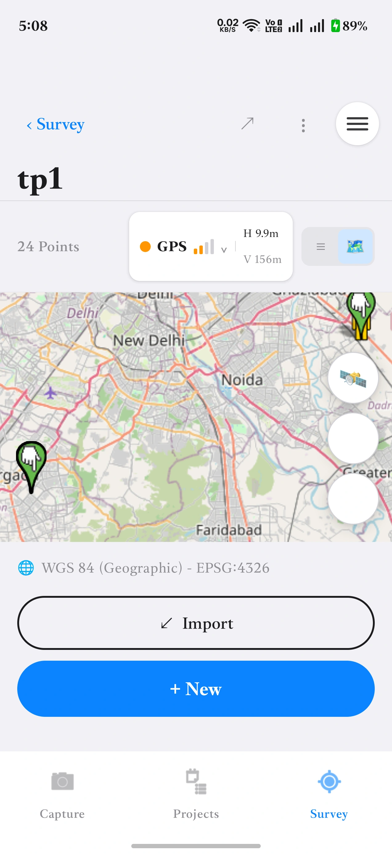
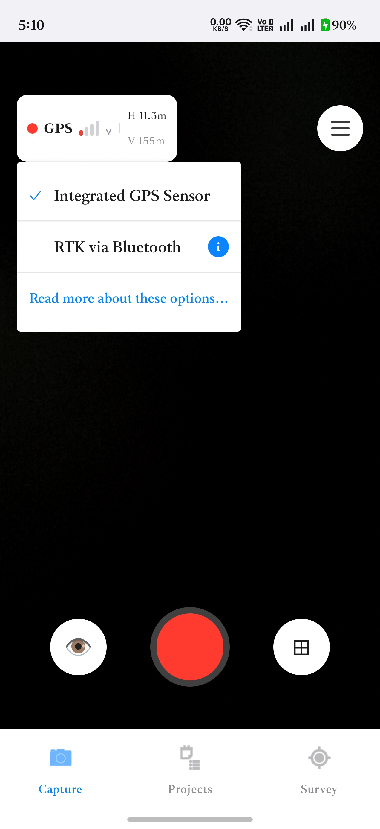
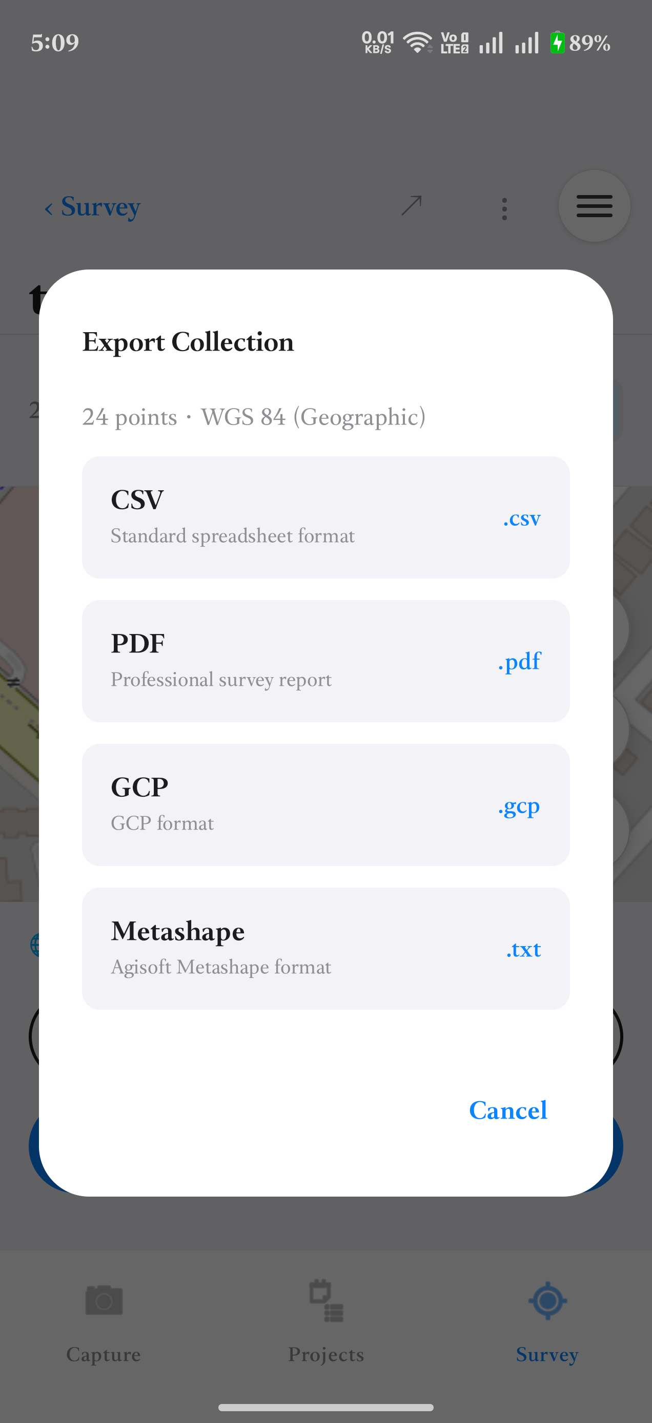
Review a collection, choose a positioning source, and export your survey.
 Open full-size image
 Open full-size image
 Open full-size image
Displayed GPS readings are example measurements, not an accuracy guarantee.
Start with a field observation. Add its position and collection context before sharing it with the project team.
INTERACTIVE CONCEPT · ILLUSTRATIVE DATA
Your team knows the site. We know the spatial workflow. Together, we can define a practical way forward.