CONNECTED SITE INFRASTRUCTURE

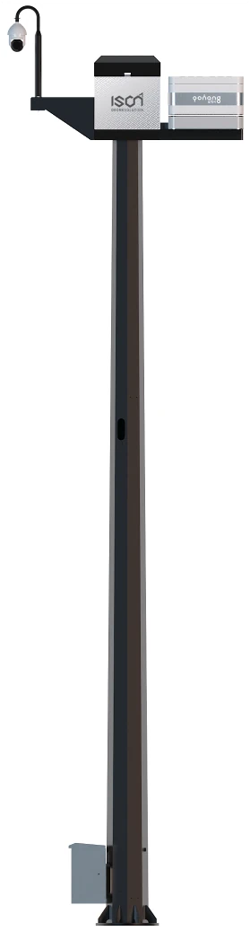
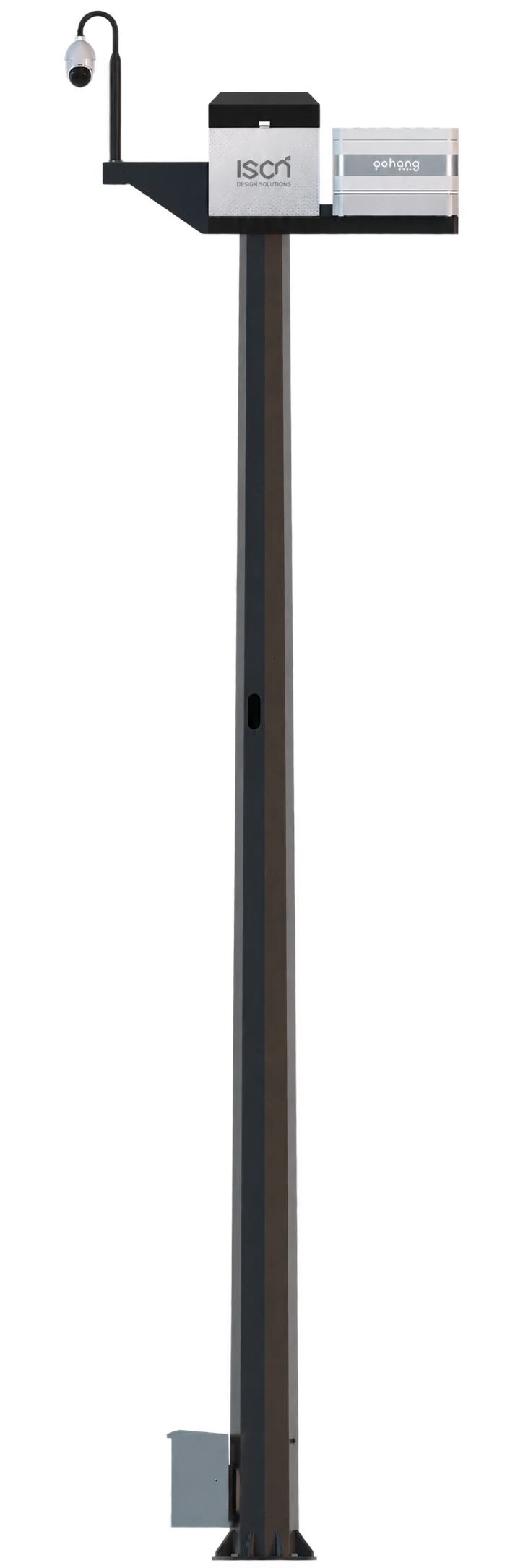
HelloGeo ArtPole™

One site. A clearer operational picture.

PRODUCT OVERVIEW

What it brings
to the workflow.

A connected site-infrastructure platform bringing pole-mounted camera views, environmental observations and station context into the HelloGeo Control Centre workflow.

The supplied Control Centre handbook describes Artpole, PTZ camera, weather and station panels. Available sensors, mounting, communications and integrations are defined for each project. AI vision and third-party counter-UAS detection are configurable requests, subject to assessment.

CONNECTED SITE / PROJECT SCOPE

Go deeper into
the product.

Define the hardware, observations and integrations around the installation.

01

Observe the site

Review camera views and PTZ context alongside site and environmental observations in the Control Centre workflow.

02

Connect the operation

Scope network access, station information, user roles and maintenance responsibilities as one deployment.

03

Add intelligence

Request AI vision or third-party counter-UAS detection integration for assessment. Installed hardware, compatibility and acceptance criteria are agreed for each project.

Earlier catalogue reference — heritage software

The earlier website catalogue described a cultural-heritage software scope under this name. That reference is retained below for continuity and is separate from the Artpole hardware shown here; it does not describe installed Artpole functions.

HelloGeo Artpole is a specialized geospatial and documentation platform designed for the preservation, conservation and management of cultural heritage assets, artworks and historical sites.

The platform integrates high-resolution 3D scanning, photogrammetry, LiDAR, multispectral imaging, condition monitoring, AI-assisted analysis and secure archival workflows—enabling conservators, archaeologists, historians and cultural institutions to document, protect and interpret our shared cultural legacy.

01 High-Resolution 3D Documentation
  • Photogrammetry and structured-light scanning
  • LiDAR and laser-scanning integration
  • Dense point-cloud generation and processing
  • High-fidelity 3D mesh and texture creation
  • Sub-millimeter precision capture
  • Scalable processing for large sites
  • Export to standard 3D formats (OBJ, PLY, FBX, 3D Tiles)
  • Quality control and accuracy assessment
02 Multispectral and Scientific Imaging
  • RGB, infrared, ultraviolet and thermal imaging
  • Multispectral and hyperspectral analysis
  • Material identification and characterization
  • Underdrawing and hidden-layer detection
  • Pigment and chemical mapping
  • Deterioration and damage visualization
  • Scientific imagery integration
  • Time-series comparison for change detection
03 Condition Assessment and Monitoring
  • Systematic condition recording
  • Damage, crack, erosion and deterioration mapping
  • Surface analysis and texture monitoring
  • Conservation intervention tracking
  • Risk and vulnerability assessment
  • Environmental impact monitoring
  • Historical condition comparison
  • Priority and urgency ranking
04 Environmental and Climate Monitoring
  • Temperature, humidity and climate logging
  • UV, light and solar radiation monitoring
  • Air quality and pollution tracking
  • Soil moisture and water-level monitoring
  • Structural vibration and movement detection
  • Microclimate analysis and modeling
  • Climate risk assessment
  • Adaptive environmental controls
05 GIS and Spatial Heritage Management
  • Interactive heritage mapping and visualization
  • Site and monument geospatial databases
  • Archaeological and historical layer integration
  • Conservation zone and buffer mapping
  • Access and visitor route planning
  • Cultural landscape assessment
  • Urban heritage and site integration
  • Secure data sharing and publication
06 AI-Assisted Heritage Analysis
  • Automated damage and anomaly detection
  • Pattern recognition in surface deterioration
  • Feature and motif identification
  • Text and inscription analysis
  • Classification of objects and artifacts
  • Change detection across time series
  • Risk prediction and scenario modeling
  • Confidence-based expert verification
07 Digital Twin and Virtual Reconstruction
  • Complete 3D digital twins of heritage assets
  • Virtual reconstruction of damaged or lost elements
  • Historical and archaeological visualization
  • Contextual immersive experiences
  • Conservation scenario simulation
  • Interactive viewing and annotation
  • Comparison of existing and reconstructed states
  • Public access and educational portals
08 Research and Academic Collaboration
  • Secure project and dataset sharing
  • Controlled access for research partners
  • Collaborative analysis and annotation
  • Dataset versioning and update tracking
  • Research publication and data citation
  • Interdisciplinary heritage workflows
  • Integration with scientific analysis tools
  • Global knowledge exchange
09 Conservation and Restoration Management
  • Intervention planning and documentation
  • Material and treatment records
  • Before-and-after comparison
  • Condition tracking over time
  • Conservation staff and resource management
  • Regulatory and compliance reporting
  • Auditable conservation histories
  • Long-term preservation strategy
10 Visitor Experience and Interpretation
  • Interactive 3D heritage experiences
  • Virtual and augmented reality integration
  • Multilingual interpretation content
  • Storytelling and narrative mapping
  • Interactive site and museum exhibits
  • Accessible cultural experiences
  • Public education and engagement
  • Community and stakeholder participation
11 Secure Archival and Long-Term Preservation
  • Digital preservation-grade storage
  • Metadata and cataloging standards
  • Long-term data sustainability
  • Multiple-site disaster recovery
  • Format migration and maintenance
  • Access and security controls
  • Comprehensive documentation records
  • Intellectual property and rights management
12 Field and Expedition Support
  • Mobile and offline data collection
  • GPS and location-based documentation
  • Site survey and mapping tools
  • Photo and video capture with metadata
  • Offline synchronization
  • Field team collaboration
  • Progress and quality tracking
  • Remote expert support
13 Integration and Interoperability
  • Integration with HelloGeo GIS Suite
  • Connection with scientific analysis tools
  • Museum and collections management systems
  • Archaeological databases and standards
  • Conservation and preservation platforms
  • Open heritage data standards
  • API-first architecture
  • Custom integration for heritage projects
How it works
  1. Capture

    Document heritage assets using photogrammetry, LiDAR, imaging and sensors

  2. Process

    Create 3D models, orthophotos, point clouds and scientific imagery

  3. Analyse

    Assess condition, identify deterioration patterns and detect changes

  4. Interpret

    Integrate historical context, research findings and expert knowledge

  5. Conserve

    Plan and document conservation interventions and treatments

  6. Share

    Publish findings, engage communities and preserve knowledge

Applications
  • Comprehensive site documentation
  • Condition monitoring and risk assessment
  • Conservation planning and tracking
  • Visitor management and interpretation
  • Reporting to UNESCO and heritage bodies
  • Scientific research collaboration
  • Public engagement and education
  • Site survey and excavation documentation
  • Stratigraphic and context recording
  • Artifact and feature mapping
  • Digital reconstruction of structures
  • Interpretation and research platforms
  • Site preservation and management
  • Public archaeology and outreach
  • 3D digitization of objects and artifacts
  • Conservation condition assessment
  • Virtual exhibitions and experiences
  • Collection management and cataloging
  • Research and analysis platforms
  • Educational and interactive displays
  • International cultural exchange
  • Structural documentation and analysis
  • Restoration and conservation planning
  • Damage and deterioration mapping
  • Environmental and climate monitoring
  • BIM and digital twin development
  • Heritage impact assessment
  • Public interpretation and access
  • High-resolution digital capture
  • Condition and conservation tracking
  • Scientific analysis and material study
  • Virtual viewing and interpretation
  • Research and provenance documentation
  • Conservation treatment planning
  • Exhibition and loan management
  • Landscape and environmental documentation
  • Historical land-use analysis
  • Conservation and management planning
  • Community and stakeholder engagement
  • Cultural and natural heritage integration
  • Risk and vulnerability assessment
  • Sustainable heritage tourism
  • Documentation of traditions and practices
  • Oral history and storytelling archives
  • Performance and ritual recording
  • Community participation and preservation
  • Cultural transmission and education
  • Intergenerational knowledge sharing
  • Cultural identity and heritage promotion
  • Shipwreck and submerged site documentation
  • Marine archaeological survey
  • 3D modeling of underwater sites
  • Condition and conservation monitoring
  • Research and interpretation platforms
  • Heritage protection and management
  • Public access and virtual diving
  • Digital preservation of heritage records
  • Image and document digitization
  • Metadata and cataloging workflows
  • Research access and publication
  • Long-term archiving strategies
  • International standards compliance
  • Collaborative heritage networks

Product content aligned to the HelloGeo official catalogue, reviewed 2026-10-09. Original product catalogue

PROJECT CONTEXT

From capability
to useful work.

From installation to useful context

Identify the site and operating objective → choose camera and sensor requirements → assess mounting, power and communications → configure the command workflow → verify the agreed outputs.

Where it can fit
  • Industrial and infrastructure site awareness
  • Campus and facility observation workflows
  • Drone Station and site camera context
  • Environmental observations connected to operational review

Hardware context: Control Centre Operator Handbook v1.1, pages 5–8.

PRODUCT RESOURCES

Explore it with your team.

THE NEXT STEP STARTS WITH A CONVERSATION

Bring us the challenge.
Let’s build the connection.

Your team knows the site. We know the spatial workflow. Together, we can define a practical way forward.